By the Solari Team
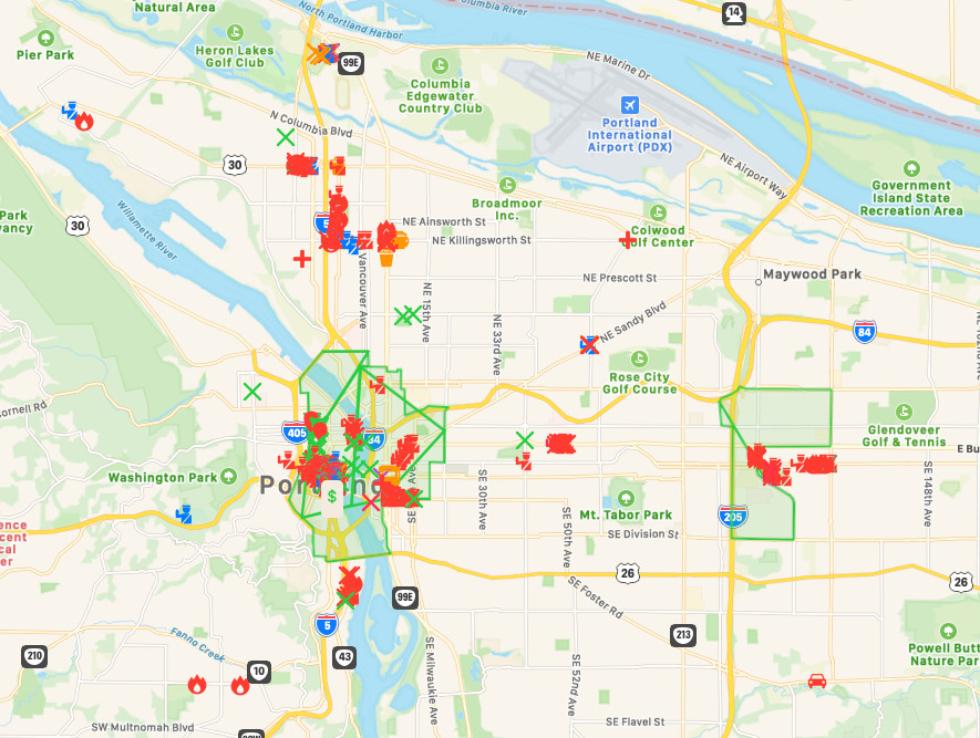
The Portland riots began in May and continue to this day. We decided to map what data we had as of October 7, 2020. A correlation between riot damage and the tax-attractive Opportunity Zones that we noted in the riot damage patterns in Kenosha and Minneapolis continues in Portland (see “Subcriber Resources” section at the bottom of the page).
If you have more detailed Portland riot damage information, we ask that subscribers post at subscriberinput[at]solari.com. If you are not a subscriber, please send your riot damage info to customerservice@solari.com. As always, we invite your input.
Sources:
In addition to Live UA Maps, we used three additional sources which are listed in “Subscriber Resources” below:
- The main source for this report was Live UA Map Timeline Aug 24 – Oct 07 2020. Stories listed were from Twitter and elsewhere, most of which referred to multiple and sometimes duplicate instances of the same event. There were only a handful of individual property damage reports. Consequently, there can be no assurance that the data we used are accurate or complete.
- KGW8 (NBC affiliate) Video and Article
- KGW8 YouTube Channel
- Portland PD Timeline Graphic
Portland riots started in May and are continuing. They are notable for the politics of confrontations and tactics:
- Shootings soar in Portland after mayor disbands Shooting Investigations Unit. Portland PD were severely handicapped by the Mayor’s actions.
- Portland Mayor Ted Wheeler Orders Police to Stop Using Tear Gas
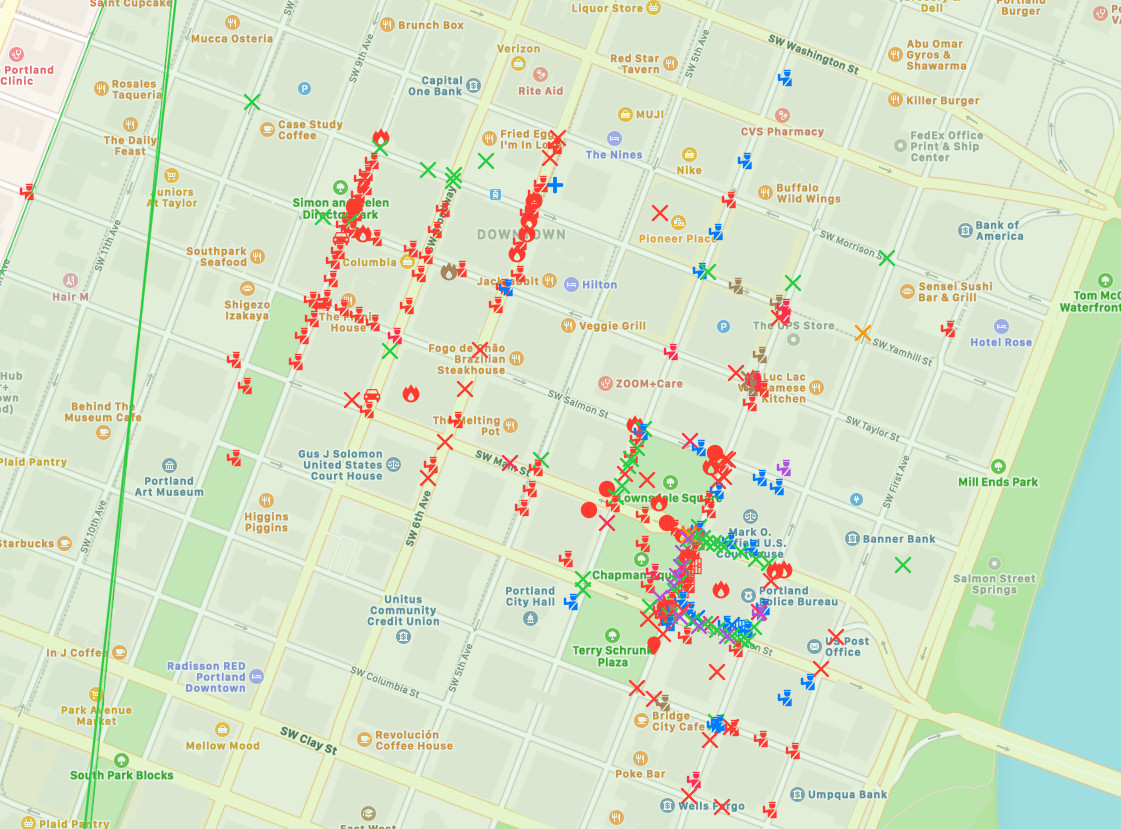
- Law Enforcement Infrastructure and Personnel were the primary targets. Police, Sheriff, ICE, Federal Court, and Local Government assets were under prolonged attacks from August 24th – Oct 7th. A tremendous amount of effort was spent on destroying the downtown area bounded on the West: by the 405, North: by West Burnside, East: Willamette River and South: SW Clay. Where a high concentration of Justice and Police facilities were.
- This also appears to be the 1st appearance of the “Proud Boys” in one of our reports. Who they are and who is financing them is unclear at the moment.
- For whatever reason, only 500 OR Army National Guard (ORARNG) Troops were activated (where 2000 were activated in Kenosha, WI).
- Federal Law Enforcement Agencies used in place of the ORARNG were: ICE, Border Patrol, U.S. Marshalls and Homeland Security forces.??
More mayoral handicaps..
Damage Statistics:
Portland protests have cost local businesses $23M to date.
What was the same?
- Though the majority of the Riot Damage was in Opportunity Zones, there was a significant amount that was not. Most of that damage was to Police / Sheriff’s and Law Enforcement Association (Pension) infrastructure.
- The Police on occasion were forced to leave the area due to superior forces.
- Police deployed Rubber Bullets, Tear Gas, Flash Bang Grenades, Pepper Spray, Pepper Balls, and hand to hand (baton, shield, etc).
- Rioters deployed Molotov Cocktails, assorted projectiles, returned tear PD gas cannisters and an assortment of clubs, projectiles, etc.
- Several shootings were reported across the Metro area during this period.
- Peaceful Protestors and Rioters were intermixed.
- Riots happened repeatedly in the same areas across the Metro area over a long time span.
- Small Business property damage was rampant.
- Residential areas were targeted by rioters.
- There appeared to be Left- and Right-wing out-of-town combatants.
- Left and Right forces inflicted casualties on each other.
- Riot Damage was very linear / symmetrical.
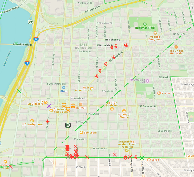
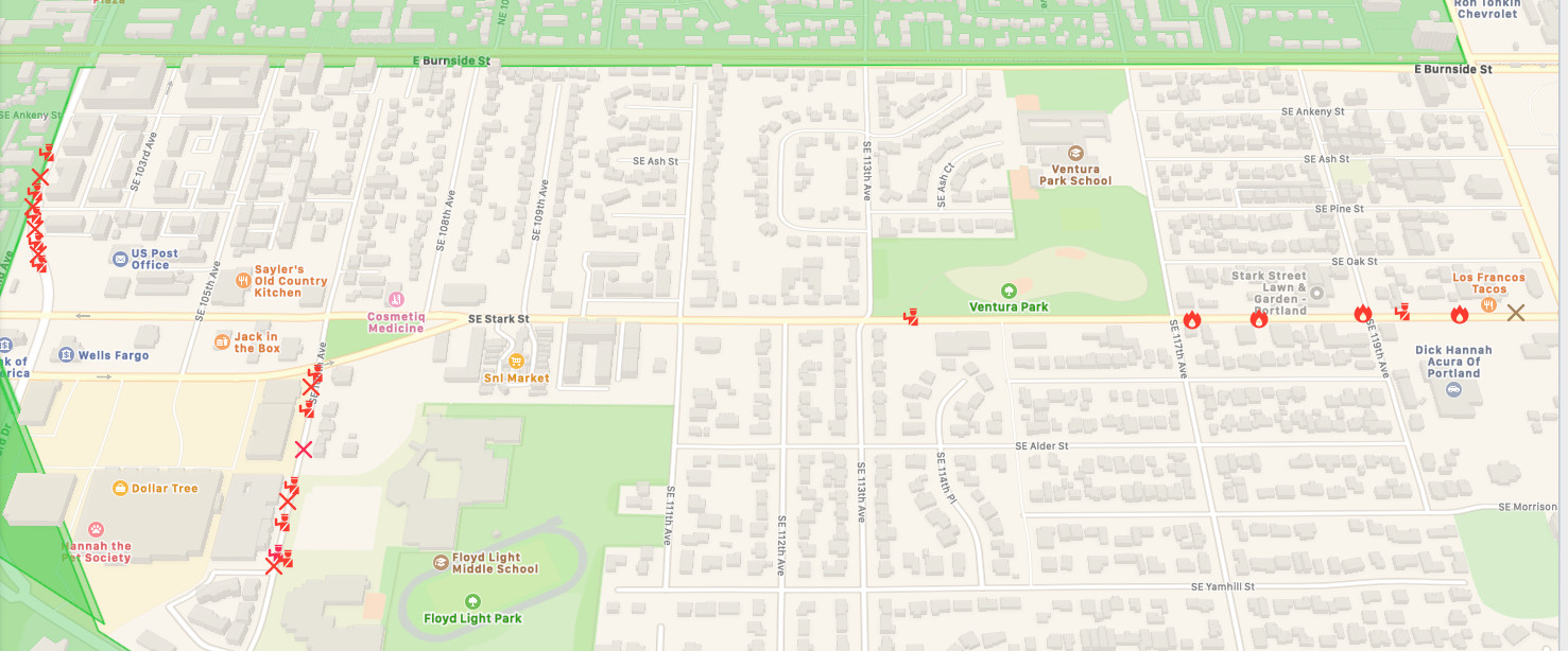
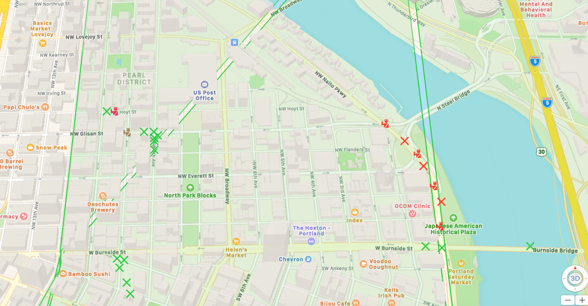
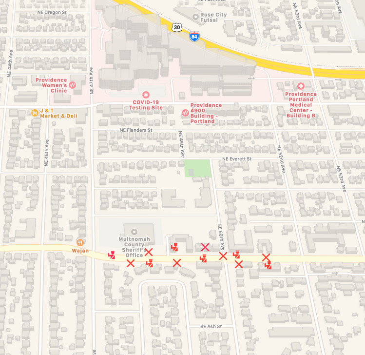
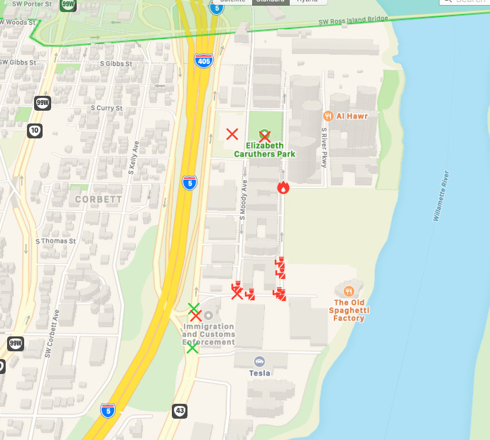
- The below maps were made w/ an Apple app called “Ahoy Map Maker.”
- Solari Generated .amap Source File download here.
(To view details of each icon / incident.)
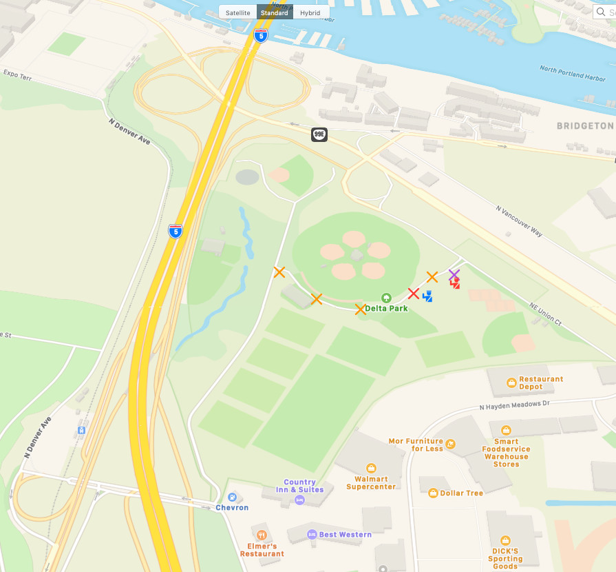
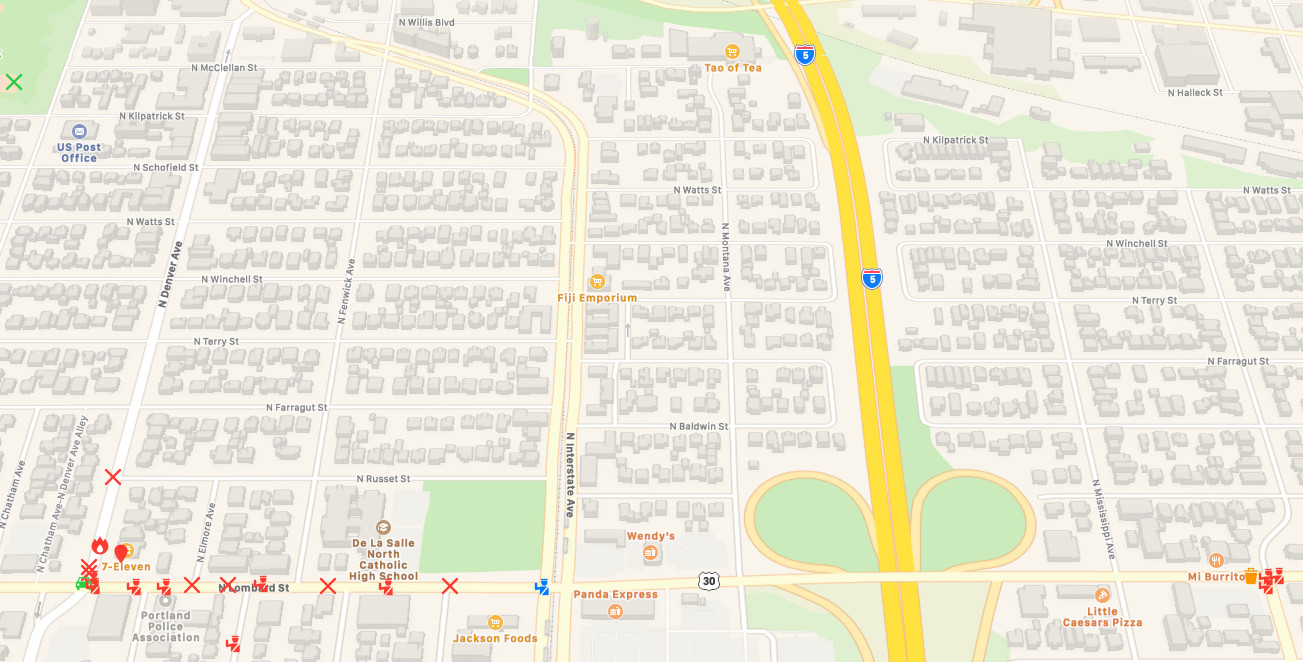
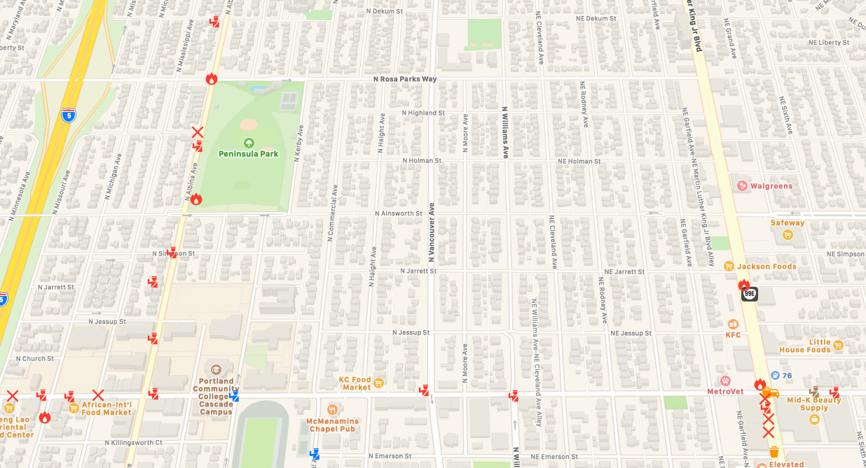
Map Key:
- Red Police Icon = PD / Rioter Confrontation
- Blue Police Icon = Police Presence, no Violence
- Red Castle Icon = OR Army National Guard / Rioter Confrontation
- Blue Castle Icon = OR Army National Guard Presence, no Violence
- Orange Police Icon = PD Expressed thanks for MAGA / Counter Riot presence
- Red X Icon = Rioter Violence and Property Damage
- Green X Icon = Protestors Amass
- Orange X Icon = Police / MAGA / Proud Boy Supporters Amass
- Orange Bus Icon = Trump Supporters Arrive
- Purple X Icon = Rioters clash PD/MAGA/Proud Boy Supporters
- Red Flame Icon = Arson
- Red Car Icon = Car set ablaze
- Red Bus Icon = Bus or Truck set ablaze
- Red Solid Circle Icon = Shots Fired
- Red Cross Icon = Gunshot Casualty / Casualties
- Light Green Trapezoids = Opportunity Zones
- Orange Garbage Can Icon / Car Icon = Rioters Blocking Roads
- Green $ = Federal Reserve Bank
Maps:
Portland Oregon Riots / Opportunity Zones Overlay
(click on map to view larger image)
Portland Downtown Central District Major Damage Map (OZ)
(click on map to view larger image)
Portland East Bank Damage Map (OZ)
(click on map to view larger image)
Portland East Precinct Damage Map
Portland Northern Downtown Area (OZ)
Portland Oregon Riots / Outside Opportunity Zones
Portland Proud Boy Rally / Riot
(click on map to view larger image)
Police Association Riot Damage Map
(click on map to view larger image)
North Central Portland Riot Damage
(click on map to view larger image)
Multnomah Sheriff’s Office Damage Map
(click on map to view larger image)
Portland ICE Riot Map
(click on map to view larger image)
Subscriber Resources:
- Portland PD Riot Incident Timeline Graphic
- KGW8 YouTube Channel
- KGW-TV Portland police create timeline, map of civil disturbances and riots (Video and Article)
- Wiki George Floyd Riots, Portland OR
- Check to see if you live in a HUD Opportunity Zone
- Minneapolis, MN Riot Maps
- Omaha, NE Riot Maps
- Kenosha, WI Riot Maps
- Columbus, OH Riot Maps
Portland Oregon:

