By the Solari Team
Preface: What was different from the Minneapolis Riots Report?
Sources:
Unlike our report on Mapping Minneapolis Riot Damage, there were no concise lists of individual property damage. The main source for this report was Live UA Map Timeline Aug 24 – Sept 04 2020. Stories listed were from Twitter and elsewhere, most of which referred to multiple and sometimes duplicate instances of the same event. There were only a handful of individual property damage reports. Consequently, there can be no assurance that the data we used are accurate or complete.
If you have detailed Kenosha riot damage information, we ask that subscribers post at Subscriber Input at Solari.com. If you are not a subscriber, please send your riot damage info to customerservice@solari.com. As always, we invite your input.
Law Enforcement Response:
The police and National Guard made their presence known. Barricades were erected, arrests were made, and there were serious efforts made to restore order (something that was totally lacking in Minneapolis). However, more disturbing events occurred:
- Occupied family residences were broken into.
- Partisan gun fights occurred and casualties were produced.
- Partisan street fights occurred and casualties were produced.
- In spite of the combined efforts of Kenosha PD and a WI Army National Guard Brigade (~2000 troops), millions of dollars in property damages were incurred.
Damage Statistics:
See “Emergency Services Stats Kenosha August 23rd-Sep 3rd” (section below the maps).
What was the same?
- Note that most of the destruction appears to have been caused within an “Opportunity Zone.” Verification underway.
- The below maps were made with an Apple app called “Ahoy Map Maker.”
- Solari Generated .amap Source File download here.
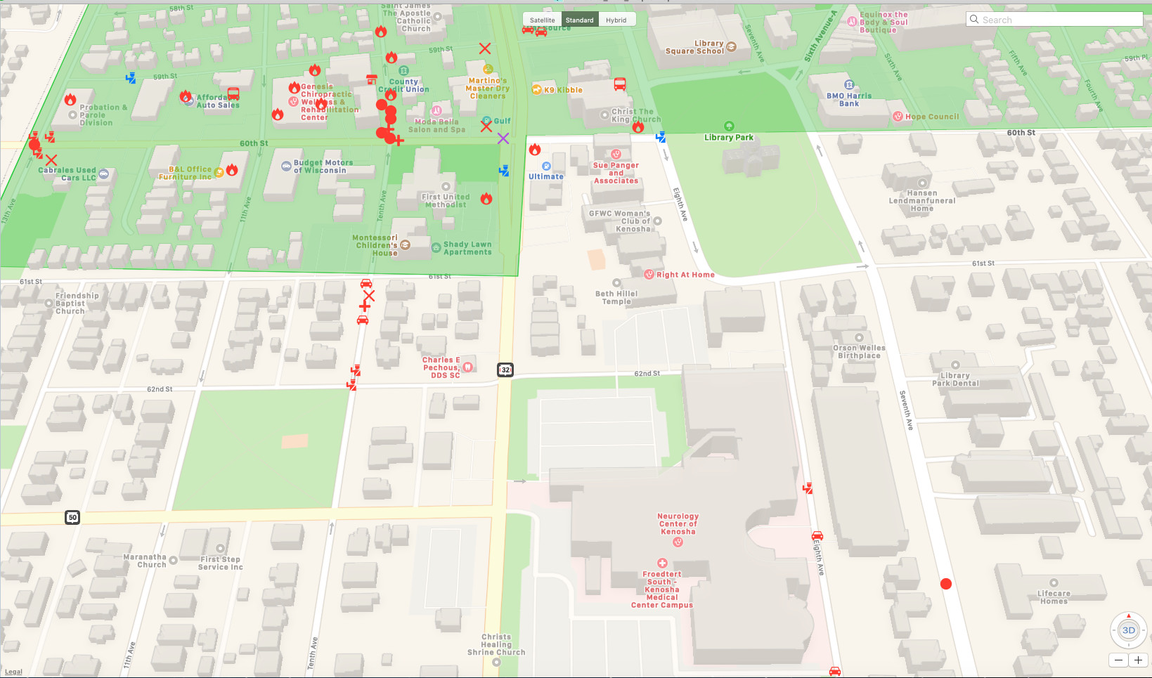
(To view details of each icon / incident.)
Map Key:
- Red Police Icon = PD / Rioter Confrontation
- Blue Police Icon = Police Presence, no Violence
- Red Castle Icon = WI Army National Guard / Rioter Confrontation
- Blue Castle Icon = WI Army National Guard Presence, no Violence
- Orange Police Icon = PD Expressed thanks for MAGA / Counter Riot presence
- Red X Icon = Rioter Violence and Property Damage
- Blue X Icon = Protestors Amass
- Orange X Icon = Police / MAGA Supporters Amass
- Purple X Icon = Rioters clash with PD/MAGA Supporters
- Red Flame Icon = Arson
- Red Car Icon = Car set ablaze
- Red Bus Icon = Bus or Truck set ablaze
- *** Blue Bus Icon = Busses used to transport out-of-town Protestors / Rioters w/o License Plates (See Related Reading Link Below)
- Red Solid Circle Icon = Shots Fired
- Red Cross Icon = Gunshot Casualty / Casualties
- Red Flag Icon = Trump Visit
- Blue Flag Icon = Biden Visit
Maps:
Kenosha Wisconsin Opportunity Zone 55059001000
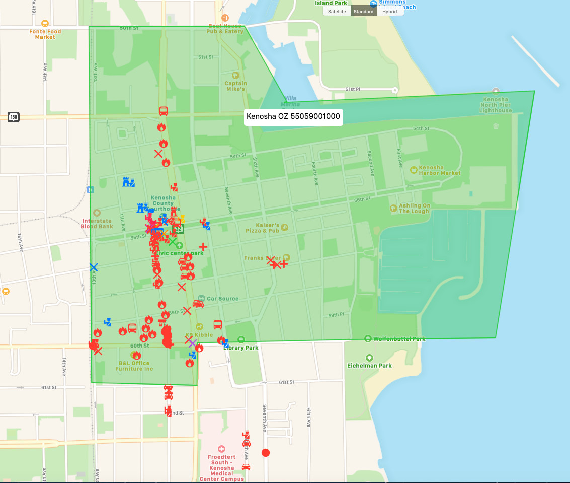
(click on map to view larger image)
Kenosha Riots North
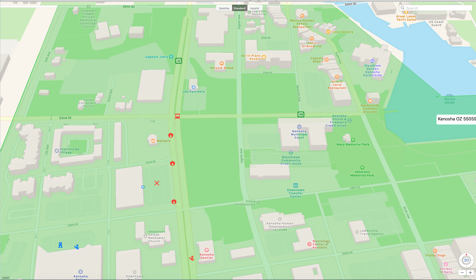
(click on map to view larger image)
Kenosha Riots Central
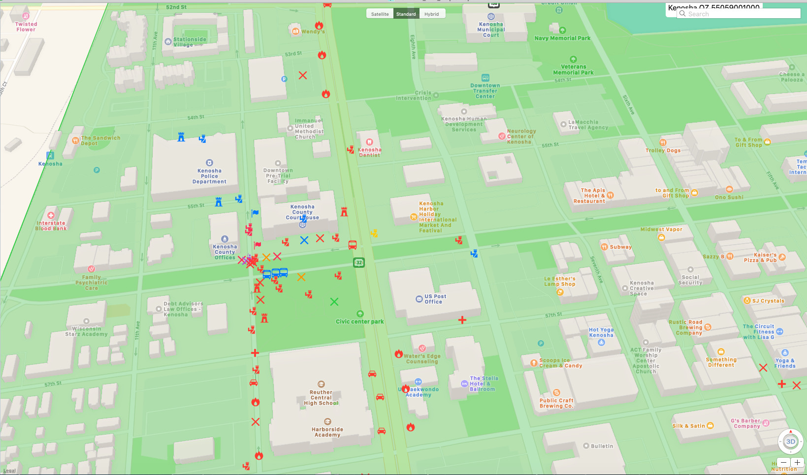
(click on map to view larger image)
Kenosha Riots South
(click on map to view larger image)
Emergency Services Stats Kenosha August 23rd-Sep 3rd:
- 175 Arrested from Out of Town
- Calls for Service = 31,204.
- 911 calls = 3,465
- Other Arrests = 252
- Kenosha City Property Damage = $2M
- Damage due to rioting, unrest in Kenosha County tops $50 million; 2,000 Guard assisted here.
- ATF Fires of Interest = +23
- Riot-Related Deaths Across the U.S., including Kenosha WI
Subsriber Resources:
- Watch: The Truth in 11 Minutes: Kyle Rittenhouse (Prepared to Protect)
- A Terrifying Eye-Witness Account of the Kenosha Riots: “Everyone in the city was getting ready for a war.” Cars and Busses w/o License plates transported out of towners.(The Organic Prepper)
- Over half the people arrested in Kenosha protests are from out of town (The NY Post)
- Check to see if you live in a HUD Opportunity Zone
Kenosha Wisconsin:
- Kenosha WI, Wiki
Note: It is ~6.5 miles from the center of Kenosha, WI to the IL state line and it is ~66.6 miles from Kenosha to Chicago.


